Wayfinding as Spatial Infrastructure
Wayfinding is a spatial communication framework embedded within architecture—not an afterthought of signage. It structures movement logic, information hierarchy, and environmental cues to enable intuitive navigation.
In large-scale developments—corporate campuses, healthcare, infrastructure, and mixed-use projects—it becomes a critical operational layer influencing efficiency, user experience, and spatial clarity.
Our consultancy integrates architectural planning, environmental psychology, graphic systems, and engineering feasibility into one cohesive strategy.
A well-designed wayfinding system reduces cognitive load and enables users to navigate environments intuitively—without reliance on excessive signage.
Wayfinding must be embedded as a core spatial strategy, not applied as a surface layer.
To achieve this, we collaborate closely with:
- Architects
- Urban planners
- Interior designers
- Structural & MEP consultants
- Project management teams
Movement, zoning, and information—structured into a cohesive navigation framework.t

Together, they create a scalable framework that ensures clarity, consistency, and intuitive navigation.
We conduct detailed spatial analysis to identify
- Primary and secondary circulation paths
- Vehicular vs pedestrian segregation
- Decision nodes (junctions, lift lobbies, corridor intersections)
- Pause points
- Visibility corridors
- Sightline obstructions
Each decision node is evaluated for:
- Required information level
- Viewing angle
- Viewing distance
- Mounting feasibility
Effective wayfinding requires structured zoning.
We develop:
- District-level zoning (macro zones)
- Building-level zoning
- Floor-level zoning
- Departmental coding systems
This includes:
- Naming conventions
- Numeric sequencing
- Alphanumeric structuring
- Color band systems
- Iconographic frameworks
Zoning must scale with future expansion phases without creating redundancy.
Information overload is the most common failure in signage systems.
We classify content into:
Primary Information
Major destinations, blocks, buildings, parking levels, public facilities.
Secondary Information
Sub-departments, sub-zones, internal corridors.
Tertiary Information
Room numbers, cabin identifiers, service areas.
Hierarchy is governed by:
- Text size ratios
- Typeface weight
- Contrast ratios
- Placement height
- Reading time
- Decision speed
This prevents visual clutter and improves processing efficiency.
It includes directories, maps, and area guides that enable users to orient themselves and plan their route effectively.
Placed at key entry points and transition zones, it supports decision-making before movement begins.
- Campus master directories
- sitemaps
- floor directories
- Zoning Boards
It provides immediate recognition at the point of destination, reducing uncertainty and strengthening user confidence within the environment.
Designed for close-range readability, it aligns with architectural context while maintaining consistency across the overall wayfinding system.
- Building identifiers
- Block letters
- Department nameplates
- Room numbers
- Entry portal branding
Positioned at critical decision points, it enables smooth transitions and prevents confusion during movement.
Designed for quick readability in motion, it supports both pedestrian and vehicular navigation across the space.
- Overhead directional boards
- Corridor arrow signs
- Vehicular directional gantries
- Parking guidance signs
It ensures compliance by clearly indicating permitted and restricted actions, supporting safe and orderly movement.
Designed for high visibility and standardization, it aligns with statutory requirements and operational protocols.
- Fire exit signs
- No-Entry zones
- Speed limit Boards
- Restricted Access Notices
- Hazard Warnings
Wayfinding strategy defines the overall navigation system—zoning logic, circulation hierarchy, information structure, and placement planning.
Signage design focuses on the visual and material aspects of individual sign elements.
Strategy comes first. Design follows.
Wayfinding should ideally be integrated during schematic design or master planning stages.
If introduced post-construction, signage becomes compensatory rather than integrated with architecture.
No. We provide wayfinding audits and retrofit planning for existing buildings, campuses, and infrastructure environments where navigation systems need restructuring or modernization.
Sign quantity is determined through:
• Circulation mapping
• Decision node identification
• Sightline studies
• Movement speed analysis
• Information density evaluation
We avoid both under-signage and unnecessary clutter.
Text height is calculated based on:
• Viewing distance
• User speed (pedestrian vs vehicular)
• Reaction time
• Contrast ratio
For vehicular signage, character height increases proportionally with travel speed to allow safe decision-making.
We align signage placement with:
• Structural grid systems
• Ceiling heights
• Facade proportions
• Entry portals
• Circulation symmetry
Wayfinding should reinforce architectural rhythm—not interrupt it.
Yes. We incorporate accessibility guidelines including:
• Mounting height standards
• Tactile and Braille integration
• Contrast compliance
• Reach range requirements
• Universal iconography
Wayfinding must serve all users.
Yes. A structured navigation system reduces:
• Front desk dependency
• Security queries
• Staff assistance interruptions
• Time lost in internal movement
It improves overall operational efficiency.
We create scalable zoning and coding systems that remain consistent across expansion phases.
Future blocks, towers, or departments can be integrated without renaming or restructuring the entire system.
• Corporate campuses
• Universities
• Healthcare facilities
• Residential townships
• Infrastructure corridors
• Airports and transport hubs
• Industrial parks
Any environment with high movement complexity benefits from structured navigation planning.
Yes. Our deliverables include:
• Signage location plans
• Typology schedules
• Message hierarchy matrices
• Technical specifications
• BOQ support
These documents enable accurate fabrication and installation
A wayfinding audit evaluates:
• Navigation clarity
• Sign redundancy
• Message inconsistency
• Visual clutter
• Structural instability
It identifies inefficiencies and recommends structured improvements.
Through strict information hierarchy, zoning discipline, and pre-defined placement logic.
We eliminate redundant messaging and prevent duplication.
External systems are evaluated for:
• Wind load
• Structural anchoring
• Corrosion resistance
• Night visibility
• Reflective grade compliance
Engineering validation is critical for long-term durability.
Color supports zoning and differentiation.
However, it must be used strategically—not decoratively—to reinforce hierarchy and orientation cues.
We integrate:
• Spatial analysis
• Architectural alignment
• Engineering feasibility
• Hierarchy discipline
• Execution awareness
We design systems that are practical, scalable, and structurally viable—not just visually appealing.


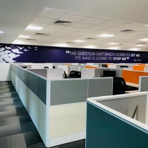
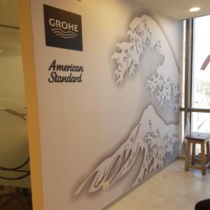
When you think of your brand move a mile extra than competitors, we execute something unique and attractive that creates a niche.
When you think of your brand move a mile extra than competitors, we execute something unique and attractive that creates a niche.

When you think of your brand move a mile extra than competitors, we execute something unique and attractive that creates a niche.

When you think of your brand move a mile extra than competitors, we execute something unique and attractive that creates a niche.
When you think of your brand move a mile extra than competitors, we execute something unique and attractive that creates a niche.
When you think of your brand move a mile extra than competitors, we execute something unique and attractive that creates a niche.
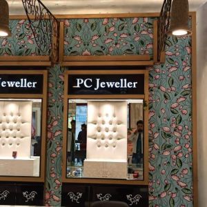
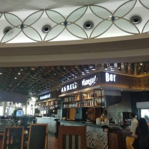
When Aura is created with craft of innovation, the ambience glitters and it makes the jewels look more beautiful. Some innovation solutions that made in-store branding a mesmerising experience.
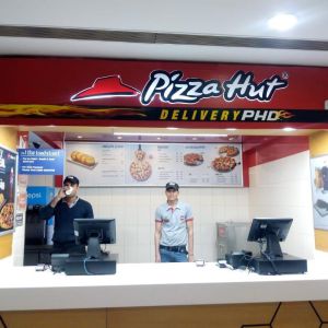
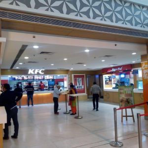
A visual delight on pizza make sit tastier.The pinch of capsicum, some jalapeños, dipping of cheese all on visual will create crazy craving.
For over a decade, MSMARCOM has been guiding people and brands through spaces with purpose-driven wayfinding design and turnkey signage solutions. Our multidisciplinary team of wayfinding consultants, designers, and architects collaborates to create intuitive navigation systems that enhance user experience and reinforce brand identity.
Phone: +91 9560855220
Website: www.msmarcom.com

908 New Hampshire Avenue Northwest #100, Washington DC
20037, United States